


Charles Precinct 09-002, Charles County, Maryland
About
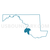
Outline

Summary
| Unique Area Identifier | 592290 |
| Name | Charles Precinct 09-002 |
| County | Charles County |
| State | Maryland |
| Area (square miles) | 16.84 |
| Land Area (square miles) | 16.79 |
| Water Area (square miles) | 0.05 |
| % of Land Area | 99.71 |
| % of Water Area | 0.29 |
| Latitude of the Internal Point | 38.53104600 |
| Longtitude of the Internal Point | -76.72493710 |
Maps


Graphs
Select a template below for downloading or customizing gragh for Charles Precinct 09-002, Charles County, Maryland


Neighbors
Neighoring Voting District (by Name) Neighboring Voting District on the Map
- Charles Precinct 08-001, Charles County, MD
- Charles Precinct 08-005, Charles County, MD
- Charles Precinct 09-001, Charles County, MD
- Prince George's Precinct 08-001, Prince George's County, MD
- St. Mary's Precinct 05-002, St. Mary's County, MD
- St. Mary's Precinct 05-003, St. Mary's County, MD
- Voting Districts not defined, St. Mary's County, MD
- Voting Districts not defined, Charles County, MD
Top 10 Neighboring County Subdivision (by Population) Neighboring County Subdivision on the Map
- District 8, Bryantown, Charles County, MD (13,400)
- District 5, Mechanicsville, St. Mary's County, MD (12,061)
- District 9, Hughesville, Charles County, MD (6,532)
- District 8, Aquasco, Prince George's County, MD (2,082)
Top 10 Neighboring Place (by Population) Neighboring Place on the Map
- Golden Beach CDP, MD (3,796)
- Hughesville CDP, MD (2,197)
- Charlotte Hall CDP, MD (1,420)
- Aquasco CDP, MD (981)
- Benedict CDP, MD (261)
Top 10 Neighboring Unified School District (by Population) Neighboring Unified School District on the Map
- Prince George's County Public Schools, MD (863,420)
- Charles County Public Schools, MD (146,551)
- St. Marys County Public Schools, MD (105,151)
Top 10 Neighboring State Legislative District Lower Chamber (by Population) Neighboring State Legislative District Lower Chamber on the Map
- State Legislative District 28, MD (143,185)
- State Legislative Subdistrict 27A, MD (90,039)
- State Legislative Subdistrict 29A, MD (46,007)
- State House Districts not defined (Prince George's County), MD (0)
- State House Districts not defined (St. Mary's County), MD (0)
- State House Districts not defined (Charles County), MD (0)
Top 10 Neighboring State Legislative District Upper Chamber (by Population) Neighboring State Legislative District Upper Chamber on the Map
- State Senate District 28, MD (143,185)
- State Senate District 29, MD (141,487)
- State Senate District 27, MD (133,899)
- State Senate Districts not defined (Prince George's County), MD (0)
- State Senate Districts not defined (St. Mary's County), MD (0)
- State Senate Districts not defined (Charles County), MD (0)
Top 10 Neighboring 111th Congressional District (by Population) Neighboring 111th Congressional District on the Map
Top 10 Neighboring Census Tract (by Population) Neighboring Census Tract on the Map
- Census Tract 8514, Charles County, MD (8,176)
- Census Tract 8750, St. Mary's County, MD (6,101)
- Census Tract 8751, St. Mary's County, MD (5,171)
- Census Tract 8513.02, Charles County, MD (4,046)
- Census Tract 8009, Prince George's County, MD (1,698)
Top 10 Neighboring 5-Digit ZIP Code Tabulation Area (by Population) Neighboring 5-Digit ZIP Code Tabulation Area on the Map
- 20601, MD (24,156)
- 20659, MD (23,498)
- 20613, MD (11,860)
- 20637, MD (5,423)
- 20622, MD (4,900)
- 20608, MD (919)
- 20612, MD (261)